



Figure5
From: A method for quantifying the upfront carbon footprint of urban densification in Texas through 2050
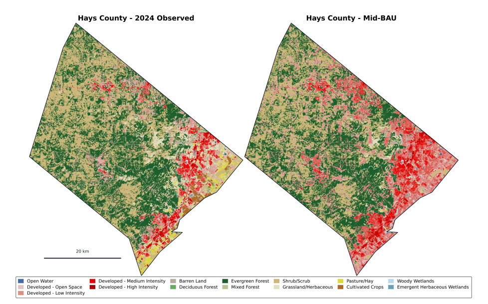
Figure 5. Example LULCC projection for Hays County, Texas, comparing observed 2024 land cover with projected 2050 land cover under the Mid-BAU scenario. With this modeling framework, developed land coverage in Hays County increases from 18.22% to 36.37%. Hays County was selected as a representative fast-growing corridor county because it contains expanding urban and suburban development while retaining substantial non-developed land. The comparison illustrates how the model allocates projected growth across existing developed areas, urban edges, and previously undeveloped land-cover classes. Hays County boundary from Esri (2014)[37].