

fig1
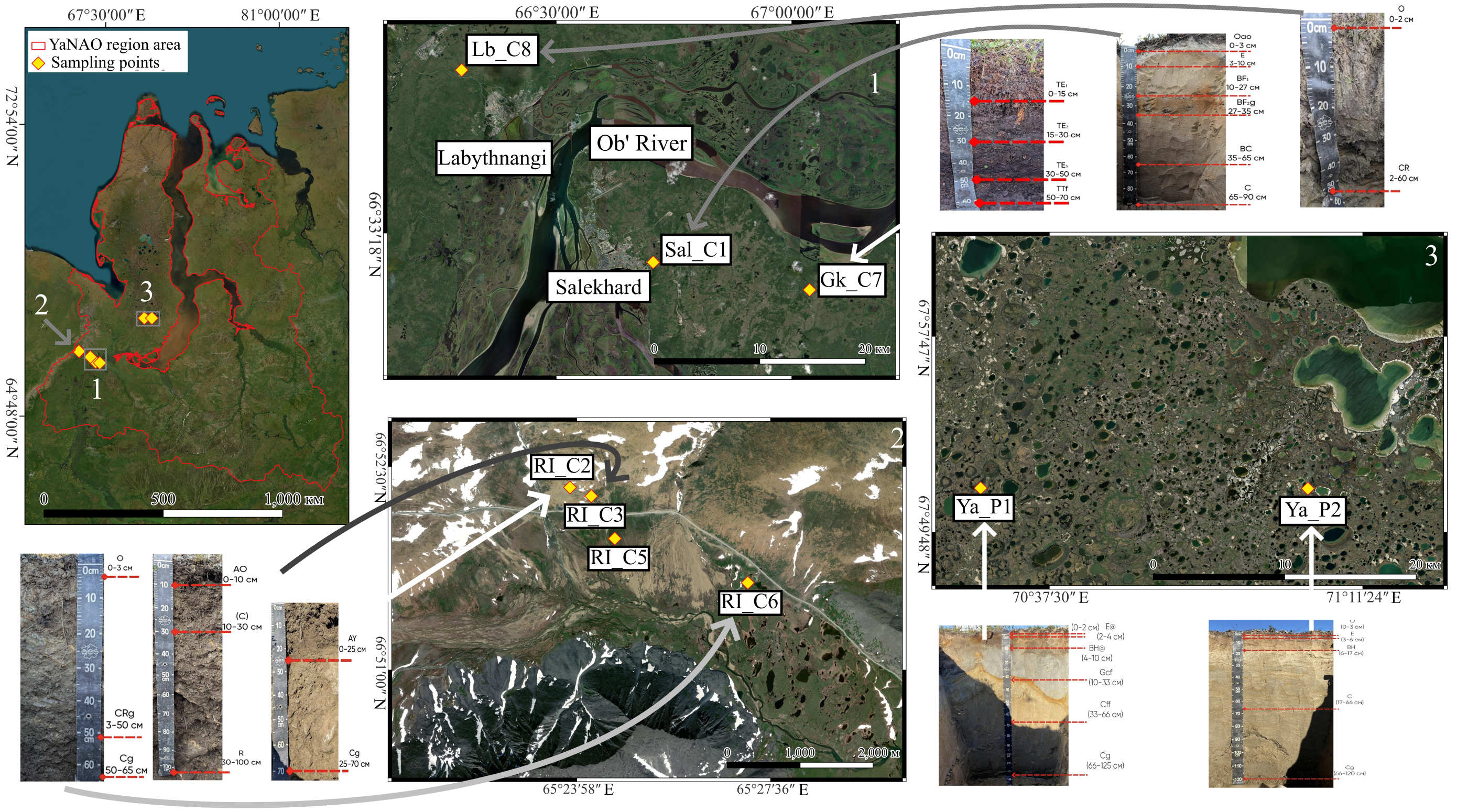
Figure 1. Location of the study areas and soil sampling sites. Satellite imagery source: Esri Satellite with radiometric calibration and atmospheric correction (Sentinel-2, resolution 10 m, acquisition date August 2025. https://browser.dataspace.copernicus.eu). The map border of the YaNAO region is taken from the National Atlas of Russia published by Roskartographia (Russian Cartography Service) in 2008 (https://nationalatlas.ru/tom3/)[26]. Satellite images were modified using QGIS 3.36.1 open-source software in order to create maps of the study areas and further merged with original images of soil profiles using Paint.NET 5.1.9 open-source software. YaNAO: Yamalo-Nenets Autonomous Okrug.